Glas
Survey & Research
Discover Glas: A Lost Mycenaean Citadel Revealed
Rising above the plains of Boeotia, the Mycenaean citadel of Glas stands as one of the most imposing and enigmatic strongholds of the Late Bronze Age. Built in the 13th century BC, during the height of Mycenaean power, Glas was not merely a fortress but a command center of agricultural and economic administration. Unlike other Mycenaean citadels primarily serving as royal residences, Glas functioned as a regional hub, overseeing the cultivation and distribution of resources from the extensively reclaimed lands of the Kopais basin.
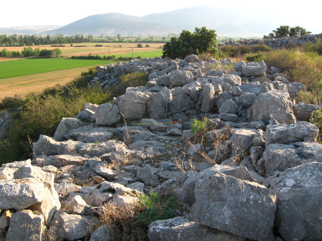
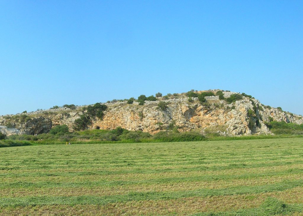
This vast basin, once a marshy expanse, was transformed by an ambitious hydraulic engineering project into a highly fertile plain, ensuring the region’s agricultural prosperity. The citadel of Glas, perched strategically on a rocky outcrop, played a crucial role in safeguarding and regulating this immense undertaking. Enclosed by a 3-kilometer-long Cyclopean wall, it was one of the largest Mycenaean fortified sites, surpassing even Mycenae and Tiryns in sheer size. Within its walls lay an intricately planned complex of administrative buildings, storage facilities, and living quarters, reflecting the structured governance and advanced infrastructure of Mycenaean civilization.
Despite its grandeur and strategic importance, Glas met a fiery demise around 1220–1200 BC, likely due to internal strife or external invasion. Unlike other Mycenaean centers, it was never reoccupied, leaving behind a monumental yet mysterious relic of a once-thriving administrative powerhouse. Today, ongoing excavations continue to unveil the secrets of Glas, offering invaluable insights into the organizational and technological capabilities of the Mycenaean world.
Transforming the Land: The Kopais Drainage System
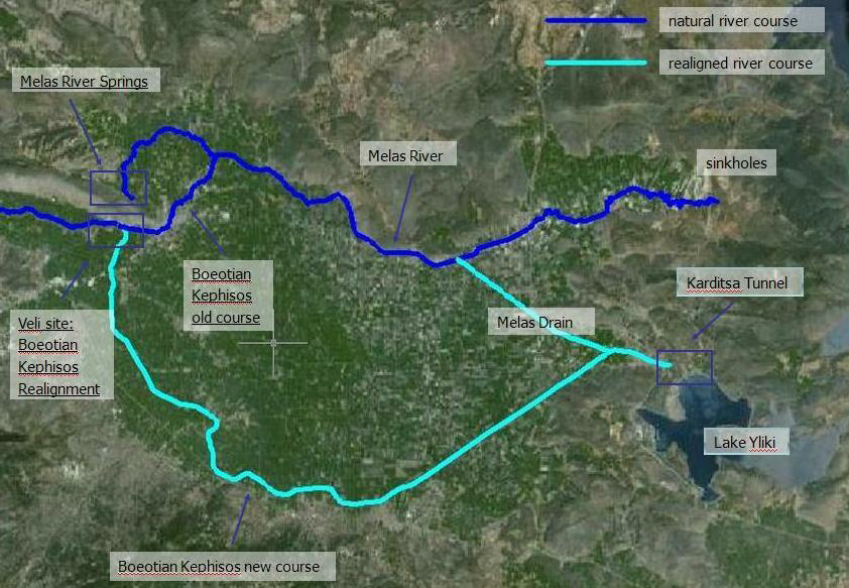
One of the most monumental engineering projects of the Mycenaean world took place in the Kopais basin, a 20,000-hectare landscape that was transformed into fertile farmland through a highly sophisticated drainage system. This extensive undertaking involved multiple layers of engineering ingenuity to regulate water flow, prevent flooding, and maximize agricultural production:
River Diversion: Natural watercourses were redirected into wide peripheral canals, controlling excess water and maintaining balanced water levels across the plain.
Massive Embankments: Huge embankments, reinforced with Cyclopean masonry, were constructed to contain and channel water, preventing seasonal flooding.
Underground Drainage System: A network of subterranean channels and tunnels allowed for controlled water flow beneath the plain, ensuring long-term soil fertility and preventing water stagnation.
Regulated Water Release: The system was designed to gradually discharge excess water into natural sinkholes and outflows, maintaining the delicate balance necessary for continuous agricultural use.
This extraordinary feat of hydraulic engineering significantly expanded agricultural yields and reinforced Mycenaean control over the region, demonstrating their administrative prowess, technological sophistication, and ability to reshape the landscape to suit their economic needs.
The Citadel of Glas: A Megafortress of the Mycenaean World
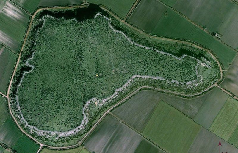
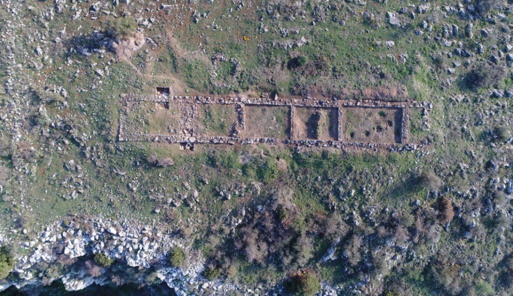
At the northeastern edge of the Kopais basin, the citadel of Glas was constructed atop a flat-topped rocky outcrop, covering an area of 20 hectares—making it substantially larger than Mycenae and Tiryns. Unlike traditional palace centers, Glas functioned as a regional storage and administrative hub, directly connected to the management of the surrounding farmland.
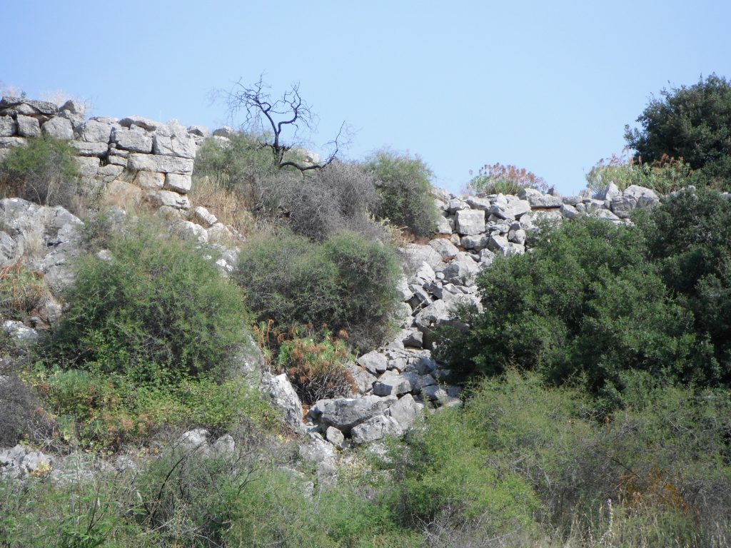
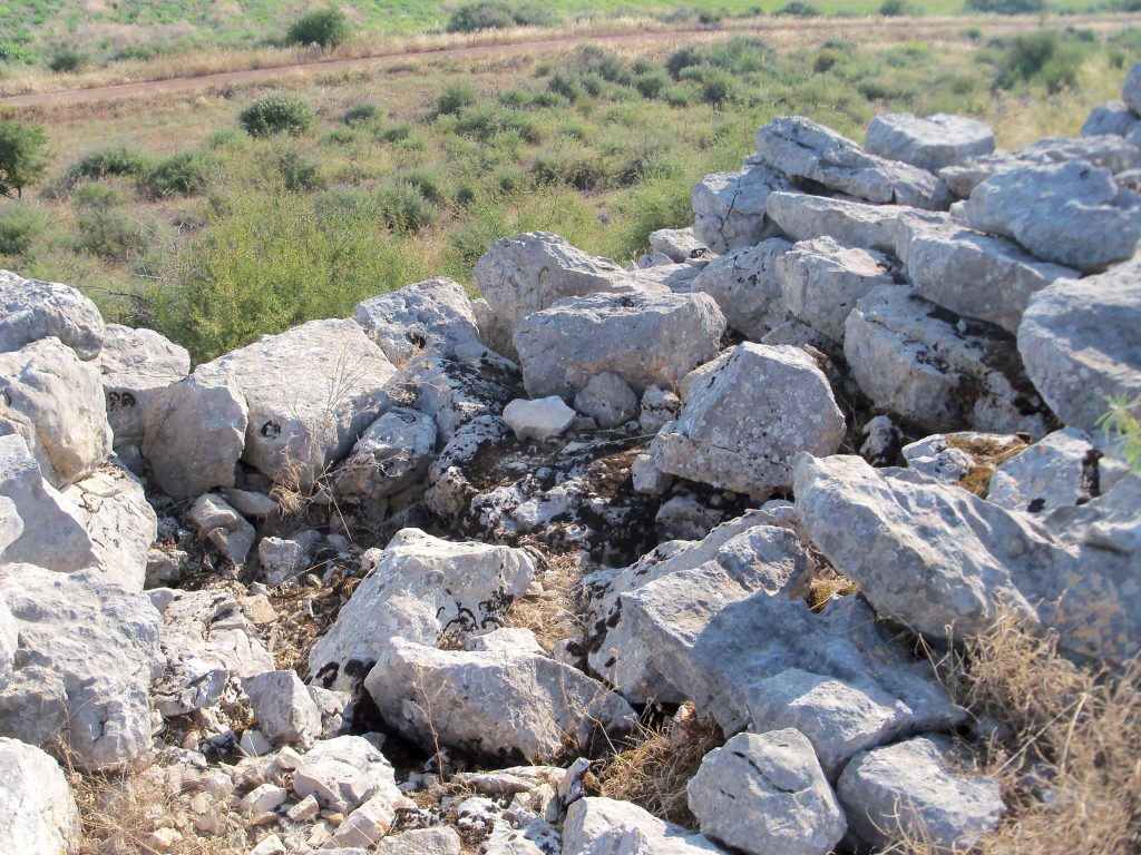
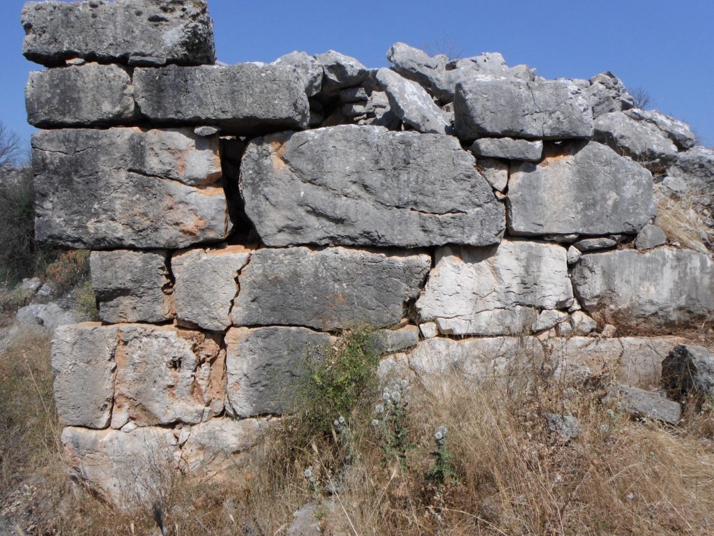
Encircling the fortress was an imposing Cyclopean wall, stretching 3 kilometers in length and measuring 5.5 to 5.8 meters in thickness. This formidable defensive barrier featured four gates, including a double-gate system, providing both security and controlled access to the citadel’s interior.

Distinctive Features of Glas
- Monumental Gates: The citadel was fortified with four grand entrances, carefully designed to serve both defensive and administrative functions, ensuring controlled access and efficient movement within the stronghold.
- Sophisticated Urban Planning: Interconnected administrative and residential complexes suggest a highly organized settlement, where governance and daily life coexisted within a meticulously planned architectural framework.
- Extensive Storage Facilities: Large-scale storage buildings indicate Glas’s vital role in managing agricultural surplus, safeguarding essential resources, and supporting regional economic stability.
- Innovative Infrastructure: The site’s advanced engineering, including drainage systems and carefully constructed terraces, reflects the ingenuity of Mycenaean builders and their ability to manipulate the landscape to sustain large populations.
Far more than a mere fortress, Glas functioned as a dynamic center of Mycenaean power. Its strategic location, expansive design, and technological advancements underscore the complexity and efficiency of Mycenaean society, demonstrating its ability to govern vast territories, regulate agricultural production, and maintain a highly organized administrative system.

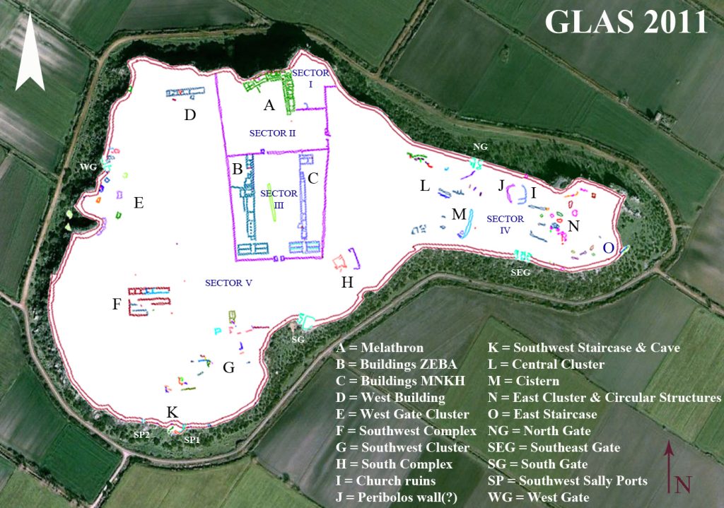
The Internal Layout: Three Interconnected Enclosures
Recent archaeological excavations have revealed the intricate layout of a citadel, highlighting its multifaceted nature and historical significance. Within this ancient stronghold, three primary enclosures have been identified, each serving a distinct and essential role in the daily life and administration of the community. These enclosures not only reflect the architectural ingenuity of the time but also provide valuable insights into the social and economic structures that defined this civilization.
Northern Enclosure (3.7 acres)
- Featured an administrative and residential complex with two elongated wings arranged at an angle.
- Each wing contained a megaron-like room, richly decorated.
- Included several two-story residential apartments connected by corridors and a central staircase, reflecting a structured and hierarchical society.
Southern Enclosure (12.6 acres)
- Served as the citadel’s primary storage and logistics hub.
- Contained two parallel storage buildings with wide access ramps, designed for efficient transport and storage of agricultural goods.
- Housed auxiliary structures such as guardhouses, personnel quarters, and kitchens, supporting daily operations.
Eastern Sector
- Separated from the rest of the citadel by an internal cross-wall, suggesting a restricted area.
- Accessible only through the eastern entrance of the double gate.
- Notably lacks visible ruins or entrances, leaving its exact function a mystery.

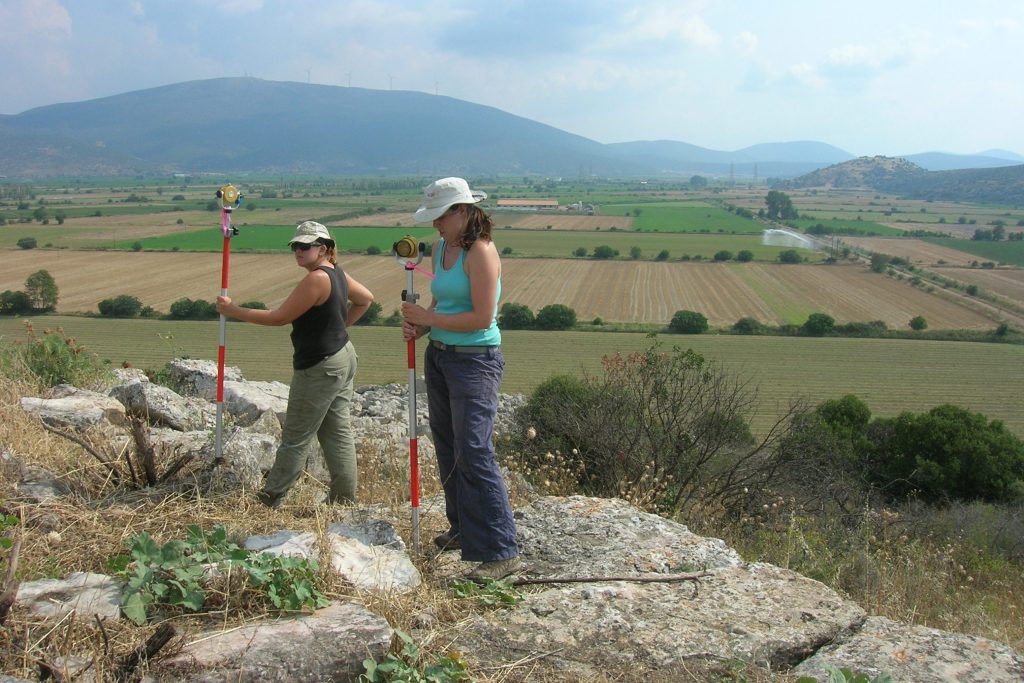
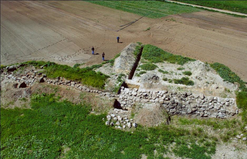
Geophysical Survey
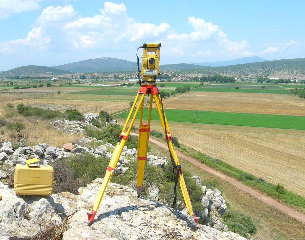
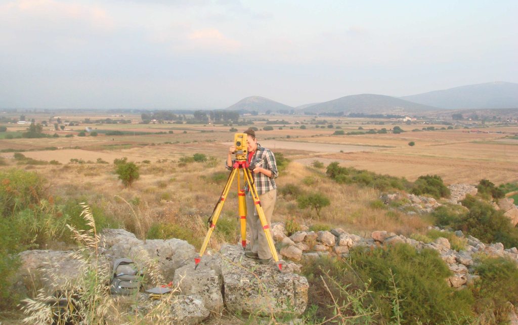
The systematic archaeogeophysical survey of the Mycenaean citadel of Glas, initiated in 2010 under the auspices of the Athens Archaeological Society and led by Prof. Christofilis Maggidis, aims to elucidate the site’s spatial organization and historical usage. This project, supported by Dickinson College and the Institute for Aegean Prehistory (INSTAP), employs advanced geophysical techniques to investigate previously unexplored areas within the citadel.
Objectives of the Geophysical Survey:
Unexplored Areas: Despite the citadel’s extensive 20-hectare area, only about one-third contains visible structures. The survey seeks to detect additional buildings, storage facilities, retaining walls, terraces, courtyards, and roads that may exist beyond the currently known sectors.
Enclosures and Spatial Organization: The citadel features distinct enclosures—northern, southern, northeastern, and eastern—each with unique characteristics. The survey aims to understand the purpose and interrelationships of these enclosures, including the seemingly isolated eastern sector accessible only through the double Southeast Gate.
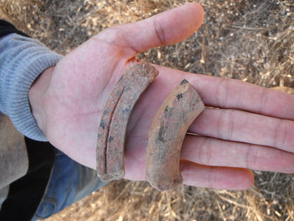
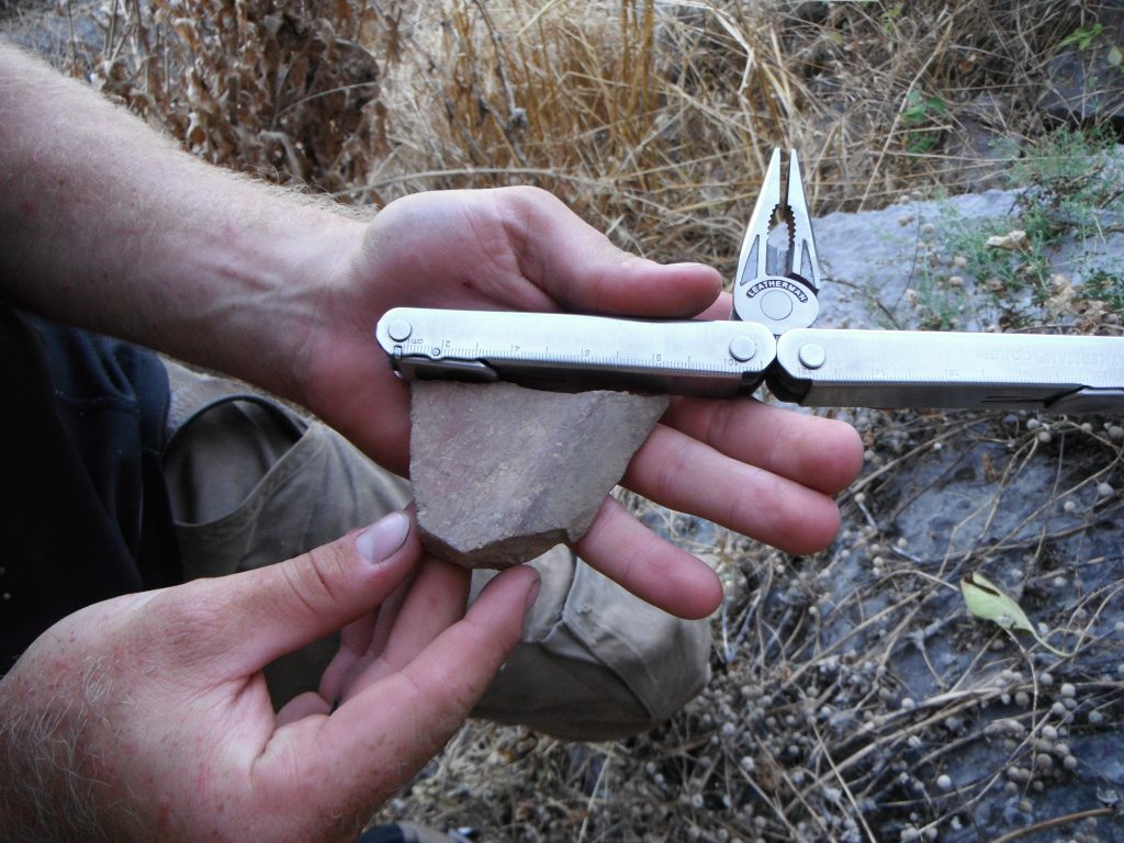
Earlier Occupation Phases: Findings of Neolithic pottery and stone tools suggest pre-Mycenaean habitation. The project endeavors to uncover evidence of these earlier settlements and understand their evolution into the Mycenaean period.
Ground Penetrating Radar (GPR)
Ground Penetrating Radar (GPR) is a geophysical method that utilizes radar pulses to image the subsurface. This technique is particularly effective for detecting and mapping subsurface structures, as it can reveal variations in material properties, moisture content, and density. The GPR system emits electromagnetic waves into the ground, which reflect off different layers and objects. The returned signals are then processed to create detailed images of the subsurface features, enabling the identification of potential archaeological remains such as walls, floors, graves, and other man-made structures.
GPR is capable of detecting anomalies at varying depths, generally up to two meters, depending on soil composition and moisture levels. This depth range makes it suitable for identifying shallow archaeological features, providing valuable data for site assessment and planning.
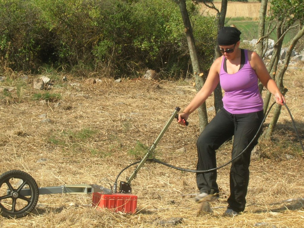
Fluxgate Gradiometers
Fluxgate Gradiometers are sensitive instruments used to measure variations in the Earth’s magnetic field. These variations can indicate the presence of subsurface features, such as ferrous materials or structures that alter the local magnetic field. In archaeological surveys, Fluxgate Gradiometers help detect features like walls, pits, and hearths, which may not be easily identified through other methods. The gradiometer measures the horizontal gradient of the magnetic field, allowing for high-resolution mapping of magnetic anomalies across the survey area. This technique is particularly useful in differentiating between natural and anthropogenic features, as human-made structures often exhibit distinct magnetic signatures due to the materials used in their construction.
Aerial Photography
In conjunction with GPR and Fluxgate Gradiometers, aerial photography enhances the survey methodology by providing a comprehensive overview of the study area. Aerial images, captured using drones or fixed-wing aircraft, allow researchers to assess landscape features, vegetation patterns, and potential archaeological sites from a broader perspective. This high-resolution imagery can reveal subtle landscape variations and highlight areas of interest for further investigation.
Aerial photography also aids in the documentation and analysis of site context, facilitating better interpretation of the data gathered from geophysical surveys. By correlating aerial images with subsurface data, researchers can develop a more nuanced understanding of the site’s history and its archaeological significance.
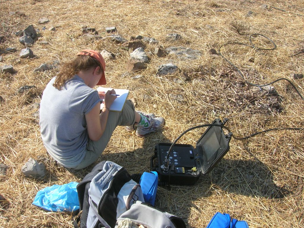
Surface Survey
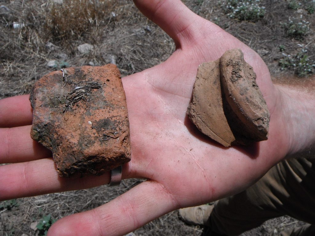
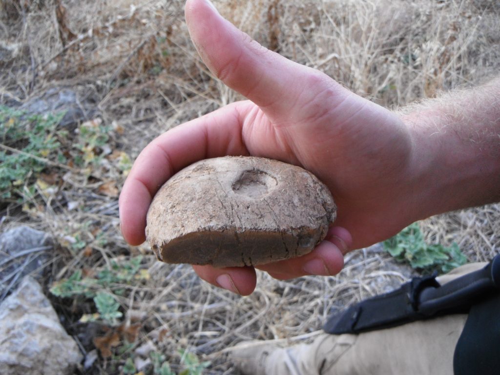
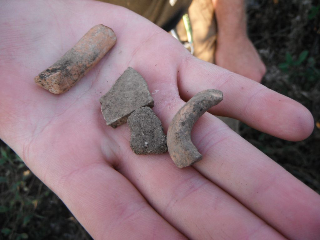
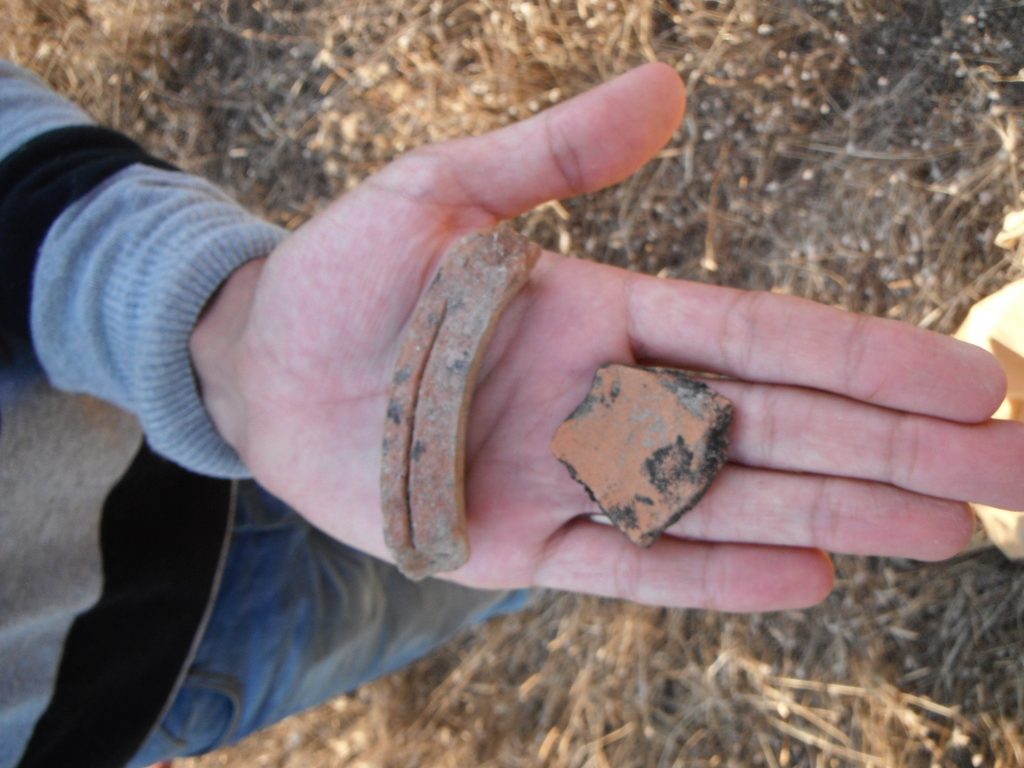
Alongside GPR, Fluxgate Gradiometers, and aerial photography, surface surveys play a critical role in the overall methodology. Surface surveys involve the systematic examination of the ground surface for artifacts, features, and other evidence of human activity. This process typically includes the collection of surface materials, such as pottery, lithics, and ecofacts, which can provide valuable information regarding the site’s occupation and use.
By integrating surface survey findings with data obtained from GPR and gradiometer analyses, researchers can establish a more comprehensive picture of the archaeological landscape. This multifaceted approach enables a more effective interpretation of the relationship between surface features and subsurface anomalies, ultimately leading to more informed conclusions about the site’s history and potential for further exploration.
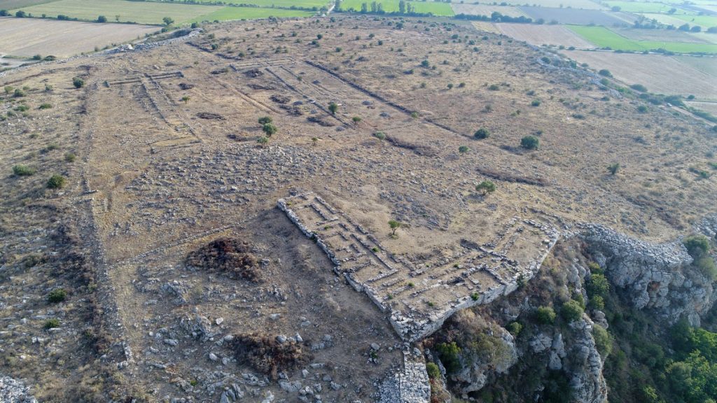
Archaeological Discoveries & Site Layout
Geophysical surveys (2010-2011) uncovered several buildings, including large complexes, smaller residential quarters, silos, and defensive structures integrated into the cyclopean fortification walls. Key findings include:
- West Building (D) & Southwest Complex (F): Large, rectangular buildings resembling storage facilities.
- South Complex (J): A major administrative center with multiple rooms.
- Eastern Sector (N): Scattered structures, circular silos, and retaining walls.
- Defensive Features: Six gates, sally ports, sentry boxes, and embedded casemates or towers.
Infrastructure: A built staircase, terraces, and a cyclopean cistern (L) for water storage.
Reevaluating Glas’s Role – Rather than an empty fortress, Glas was a thriving Mycenaean urban center. It managed agricultural production, taxation, storage, and redistribution while maintaining regional security. The settlement’s strategic layout suggests it played a crucial role in Mycenaean geopolitics.
Historical & Political Implications – The site’s significance extends beyond its military function. While Glas was initially linked to nearby Mycenaean cities like Orchomenos, an emerging hypothesis suggests it may have served as a relocated Orchomenos after the draining of the Kopais basin in the 13th century BC. This relocation theory could explain the simultaneous decline of Orchomenos and the peak of Glas.
Conclusion – Glas challenges traditional interpretations of Mycenaean urban planning. Far from being a mere fortress, it was a sophisticated administrative and residential center with deep geopolitical implications. These findings reshape our understanding of Mycenaean civilization and its regional power dynamics.